


Geographic Information System
Geographic Information System介绍
The app is a complete free handbook of Geographic Information System- GIS which covers important topics, notes, materials & news on the course. Download the App as a reference material & digital book for Civil & other engineering programs & degree courses.
This useful App lists 100 topics with detailed notes, diagrams, equations, formulas & course material, the topics are listed in 5 chapters. The app is must have for all the engineering science students & professionals.
The app provides quick revision and reference to the important topics like a detailed flash card notes, it makes it easy & useful for the student or a professional to cover the course syllabus quickly just before an exams or job interviews.
Also get the hottest international engineering & technology news on your app powered by Google news feeds. We have customised it so that you get regular updates on the subject from international/national colleges, universities, research, industry, applications, engineering, tech, articles & innovation.
This is the best application to remain updated on your fav. subject.
Use this useful engineering app as your education tool, utility, tutorial, book, a reference guide for syllabus and explore study course material, aptitude tests & project work.
Track your learning, set reminders, edit, add favourite topics, share the topics on social media.
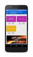
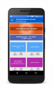
Some of the topics Covered in this application are:
1. INTRODUCTION OF GIS
2. GIS to Geocomputation
3. Technological Facilitation
4. BASIC FUNCTIONALITY OF GIS
5. A SYSTEM DEFINITION OF GIS
6. GIS Science and the Rise of Geo-Information Engineering
7. GIS SCIENCE TO FOLLOW
8. ISSUES OF GISCIENCE AS SELECTIVE GROUPING OF ASPECTS
9. INTRODUCTION OF CARTOGRAPHY
10. GEOINFORMATION TECHNOLOGY AND CARTOGRAPHY
11. COORDINATE SYSTEM
12. GLOBAL SYSTEMS
13. PROJECTION BASICS FOR GIS PROFESSIONALS
14. MAP SCALE
15. MAP PROJECTION
16. GEOMETRIC TRANSFORMATION
17. VECTOR AND RASTER DATA
18. SAPATIAL PHENOMENON OF GIS
19. SPATIAL DATA FUNCTION
20. DATA COLLECTION TECHNOLOGIES
21. REMOTE SENSING
22. GROUND SURVEY
23. The Role and Nature of Environmental Models
24. CONTEXT OF ENVIRONMENTAL MODELLING
25. A SUMMARY OF MODEL DEVELOPMENT
26. APPLYING MODELS
27. MODELLING LANDSLIDES
28. MODELLING TOPOGRAPHY
29. TYPOLOGY OF MODELS
30. APPROACHES TO MODELLING
31. REPRESENTATION AND COMPUTATION OF GEOGRAPHIC DYNAMICS
32. TEMPORAL MODELLING
33. TEMPORAL GIS
34. DATABASE CONCEPTS
35. DATABASE DESIGN
36. DATA INPUT TECHNIQUES
37. DATA ENCODING
38. GLOBAL POSITIONING SYSTEM(GPS)
39. COMPARISON OF ENCODING AND DECODING
40. MAP LAYOUTS
41. MAP LAYOUTS ELEMENTS
42. COMPLETING MAPS AND SEQUENCES
43. SEQUENCING TECHNOLOGIES
44. MAPPING TECHNOLOGY
45. EVALUATING MODELS
46. MAP ALGEBRA
47. MAP ELGEBRA INPUT TYPES
48. OVERLAY ANALYSIS
49. VECRTOR AND RASTER OVERLAY
50. TARAIN MODELLING
51. SPATIAL INTERPOLATION
52. TRANSFER FUNCTION
53. GIS & ARTIFICIAL NEURAL NETWORKS
54. NETWORKS
55. GIS AND NETWORK ANALYSIS
56. WATER RESOURCE APPLICATIONS OF GIS
57. HYDROLOGIC MODELLING
58. GIS AND SOCIETY
59. GIS AND TRANSPORTATION
60. GIS BASED ASSESSMENT OF GEOTECHNICAL CHARACTIRISTICS
61. GEOTECHNICAL STRUCTURES
62. SPATAIL DATA GENERILAZTION IN GIS
63. WEB MAPPING
64. IMPORTANCE OF WEB BASED DESIGN
65. ENVIRONMENTAL IMPACT ANALYSIS
66. MAP SERVICE
67. ESTABLISHMENT AND DEVELOPMENT OF EFA MONITORING SYSTEMS
68. GIS IN UTILITY MANAGEMENT
69. THEMTIC MAPPING
70. Restructured-Accelerated Power Development and Reforms Programmed
71. GIS IN UTILITY MANAGEMENT
72. THEMTIC MAPPING
73. Restructured-Accelerated Power Development and Reforms Programmed
74. PHOTOGRAMMETRY
75. MOBILE MAPPING
Each topic is complete with diagrams, equations and other forms of graphical representations for better learning and quick understanding.
GIS is part of Civil & other engineering education courses and technology degree programs of various universities.
应用程序是地理信息系统 - GIS的一个完整的自由手册涵盖的重要主题,笔记,资料和新闻在球场上。下载App作为参考材料和数字书,土木等工程项目及学位课程。
这个有用的应用程序列出100议题有详细的注释,图表,公式,公式和课程材料,题目中列出了5章。应用程序是必须为所有的工程专业的学生和专业人士。
该应用程序提供了快速修改和参考像一个详细的闪存卡音符的重要主题,但很容易和有益的学生或专业人士来迅速覆盖课程大纲只是一个考试或面试前。
还可以得到您的应用搭载谷歌新闻最热的国际工程与技术新闻源。让您得到从国际/国内高校,科研,产业,应用,工程,技术,物品和创新的主题定期更新,我们已经定制了。
这是为了保持对你最爱最新最好的应用。学科。
使用这个有用的应用工程作为教育工具,工具,教程,书籍,对于课程的参考指南,探索研究教材,能力测试和项目工作。
跟踪学习,设置提醒,编辑,添加喜爱的主题,分享到社交媒体的主题。
一些在此应用中讨论的主题有:
1.引入GIS
2. GIS地理计算到
3.技术便利
4. GIS的基本功能
5.系统定义的GIS
6. GIS科学与地理信息工程的兴起
7. GIS科学跟随
8.问题研究的地理信息科学作为选择性的分组问题
9.介绍制图
10.地理信息技术和制图
11.坐标系
12.全球系统
13.投影基础知识GIS专业人员
14.地图比例尺
15.地图投影
16.几何变换
17.矢量和栅格数据
18. GIS的SAPATIAL现象
19.空间数据功能
20.数据收集技术
21.遥感
22.地面调查
23.角色和环境模型的性质
24.背景环境的建模
25.模型发展综述
26.模型应用
27.滑坡建模
28.地形建模
29. TYPOLOGY模型的
30.实施途径建模
31.代表性和地理动力学计算
32.时空建模
33.时空GIS
34.数据库的概念
35.数据库设计
36.数据输入技术
37.数据编码
38.全球定位系统(GPS)
39.比较编码和解码
40.地图LAYOUTS
41.地图布局元素
42. COMPLETING MAPS和序列
43.测序技术
44.测绘技术
45.评价中模型
46.地图代数
47. MAP ELGEBRA投入类型
48.叠加分析
49. VECRTOR和栅格叠加
50. TARAIN建模
51.空间插值
52.传递函数
53. GIS和人工神经网络
54.网络
55.地理信息系统和网络分析
GIS技术56.水资源应用
57.水文建模
58.地理信息系统与社会
59.地理信息系统,交通运输
岩土CHARACTIRISTICS 60.基于GIS的评估
61.土工结构
62. SPATAIL数据GENERILAZTION GIS中的
63.网络制图
64.重要性基于Web的设计
65.环境影响分析
66.地图服务
67.建立和全民教育监测系统开发
68.在GIS公用设施管理
69. THEMTIC映射
70.重组,加速电力发展与改革编程
71.在GIS公用设施管理
72. THEMTIC映射
73.重组,加速电力发展与改革编程
74.摄影测量
75.移动地图
每个主题都配有图表,方程式等形式更好地学习和快速了解图形表示的。
GIS是土木等工程教育课程和各大学的技术学位课程的一部分。
Geographic Information System - 版本5.4
(24-02-2020)Geographic Information System - APK信息
APK版本: 5.4程序包: com.faadooengineers.free_geoinformaticssystemGeographic Information System的最新版本
其他版本


同类应用